
IngeMAPs
IngeMAPs
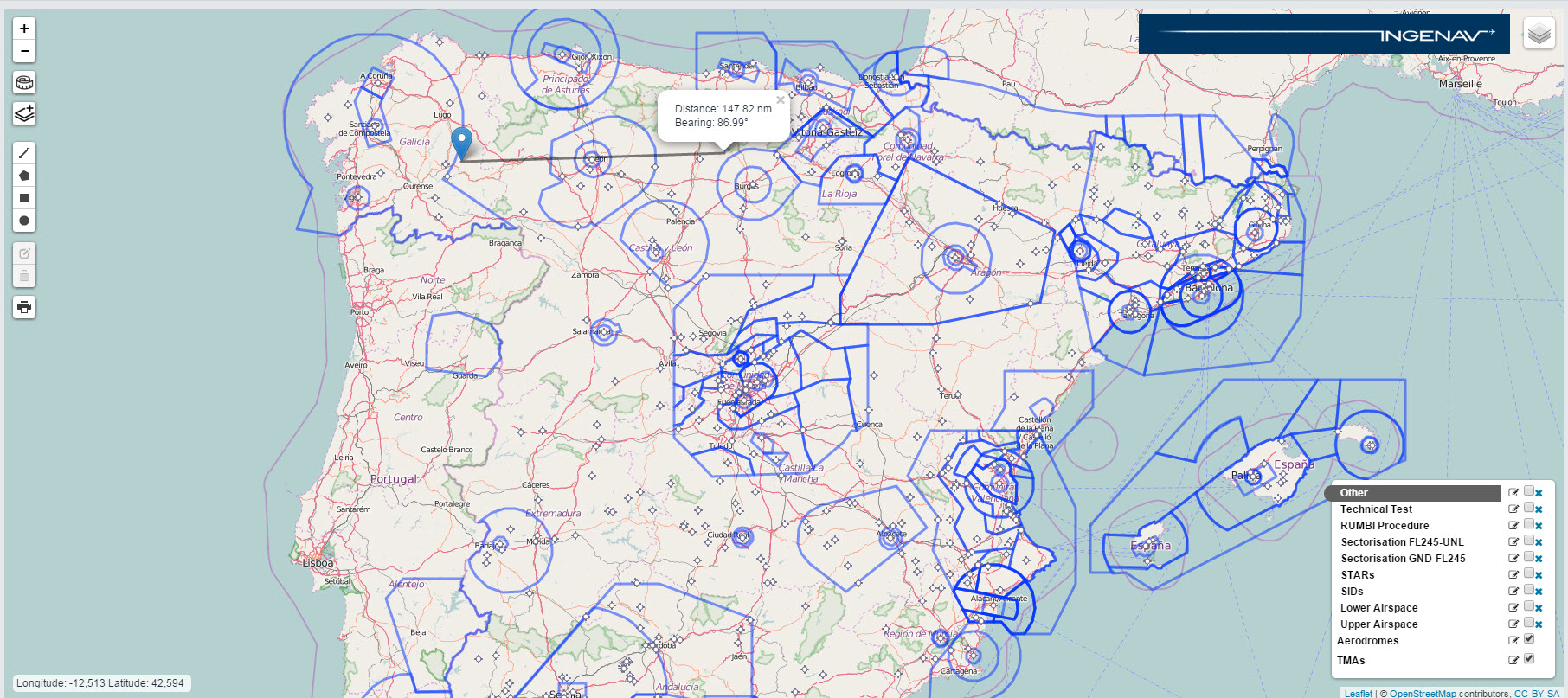
IngeMAPs is an online-based tool which enables Air Navigation Services operational experts to access aeronautical chart information pertinent to their areas of responsibility in a layered manner, and the ability to add other layers with additional custom-made drawings and annotations.
The results could be stored in the user’s accounts, shared with other users, or exported to standard formats such as PDFs, images, etc.
The benefit of this tool is that it provides ANS operational experts with software that does not require extra knowledge to be manipulated and which will enable them to easily design and visualize possible impacts of procedures or maneuvers within their areas of responsibility, and to communicate this information with others in an easy way.
Come and discover IngeMAPs at the World ATM Congress!
Features:
- Personalised Account
- Multi Layerd Representation of Aeronautical Information
- A Geographical Reference Layer
- Creation and saving of other Layers
- Drawing Tools
- Bearing and Distance Tool
- Coordinates
- Text on Map
- Export features of Maps to Image formats and PDFs
And more.
For more information
For more information send an email to info@ingenav.com or call on +34 911 697 641 or fill the form below:
Services: